


Voting District 51000, Stanislaus County, California
About
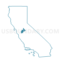
Outline

Summary
| Unique Area Identifier | 545164 |
| Name | Voting District 51000 |
| County | Stanislaus County |
| State | California |
| Area (square miles) | 39.74 |
| Land Area (square miles) | 39.30 |
| Water Area (square miles) | 0.44 |
| % of Land Area | 98.89 |
| % of Water Area | 1.11 |
| Latitude of the Internal Point | 37.55864740 |
| Longtitude of the Internal Point | -121.07124350 |
Maps


Graphs
Select a template below for downloading or customizing gragh for Voting District 51000, Stanislaus County, California


Neighbors
Neighoring Voting District (by Name) Neighboring Voting District on the Map
- Voting District 20210, Stanislaus County, CA
- Voting District 20310, Stanislaus County, CA
- Voting District 20395, Stanislaus County, CA
- Voting District 30690, Stanislaus County, CA
- Voting District 51001, Stanislaus County, CA
- Voting District 51005, Stanislaus County, CA
- Voting District 51075, Stanislaus County, CA
- Voting District 51080, Stanislaus County, CA
- Voting District 51085, Stanislaus County, CA
- Voting District 51086, Stanislaus County, CA
- Voting District 51110, Stanislaus County, CA
Top 10 Neighboring County Subdivision (by Population) Neighboring County Subdivision on the Map
- Modesto CCD, Stanislaus County, CA (312,842)
- Turlock CCD, Stanislaus County, CA (82,457)
- Patterson CCD, Stanislaus County, CA (26,139)
- Salida CCD, Stanislaus County, CA (19,467)
- Westport CCD, Stanislaus County, CA (4,000)
Top 10 Neighboring Place (by Population) Neighboring Place on the Map
- Modesto city, CA (201,165)
- Ceres city, CA (45,417)
- Grayson CDP, CA (952)
- Cowan CDP, CA (318)
- Monterey Park Tract CDP, CA (133)
Top 10 Neighboring Elementary School District (by Population) Neighboring Elementary School District on the Map
- Modesto City Elementary School District, CA (114,336)
- Chatom Union Elementary School District, CA (4,459)
- Shiloh Elementary School District, CA (749)
Top 10 Neighboring Secondary School District (by Population) Neighboring Secondary School District on the Map
- Modesto City High School District, CA (267,086)
- Turlock Unified School District in Chatom Union, CA (4,467)
Top 10 Neighboring Unified School District (by Population) Neighboring Unified School District on the Map
Top 10 Neighboring State Legislative District Lower Chamber (by Population) Neighboring State Legislative District Lower Chamber on the Map
Top 10 Neighboring State Legislative District Upper Chamber (by Population) Neighboring State Legislative District Upper Chamber on the Map
Top 10 Neighboring 111th Congressional District (by Population) Neighboring 111th Congressional District on the Map
Top 10 Neighboring Census Tract (by Population) Neighboring Census Tract on the Map
- Census Tract 25.01, Stanislaus County, CA (7,036)
- Census Tract 30.02, Stanislaus County, CA (6,818)
- Census Tract 33, Stanislaus County, CA (5,077)
- Census Tract 31, Stanislaus County, CA (4,000)
- Census Tract 36.03, Stanislaus County, CA (3,952)
- Census Tract 40, Stanislaus County, CA (3,822)